Watershed conditions
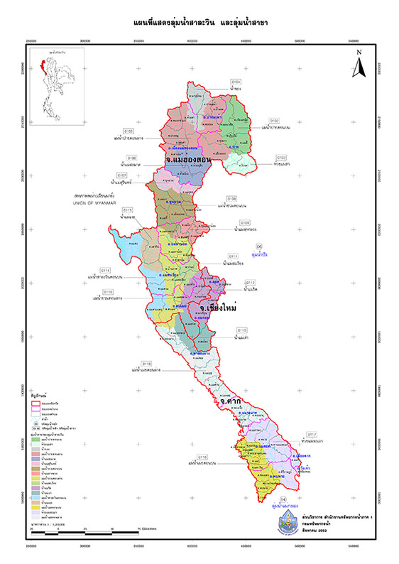
Salween River Basin The Salween River is the number one of the 25 major river basins in Thailand. It is an international river originating in the Tibetan mountains in lower northern China, flowing south through China, eastern Myanmar, through Shan and Kayah states, and forming the border between Myanmar and Thailand near Mae Hong Son province. It then turns back into Myanmar before emptying into the Andaman Sea at the Gulf of Martaban near Mawlamyine. Its length is approximately 2,200 km, with about 127 km passing through the Thai-Myanmar border. The Salween River basin in Thailand covers Mae Hong Son province and parts of Tak, Chiang Mai, and Kamphaeng Phet provinces, encompassing an area of approximately 17,920 square kilometers. The terrain is characterized by complex mountainous terrain.
Subbasin division
The Salween River Basin (in Thailand) is divided into 9 sub-basins: the Upper Pai River Basin, the Huai Mae Sa Basin, the Khong River Basin, the Lower Mae Pai River Basin, the Mae Samat River Basin, the Mae Surin River Basin, the Upper Mae Yuam River Basin, the Mae La Luang River Basin, and the Lower Mae Yuam River Basin.
map
Watershed boundaries, administrative boundaries, water resource development projects.
Personnel
Salween River Basin Coordination and Management Division / River Basin Sub-Committee / River Basin Working Group
Network
Existing network, youth network, new network, strong network.
For more information, please inquire.
Office location 175 Moo 8, Pang Mu Subdistrict, Mueang District, Mae Hong Son Province 58000
Telephone number: 0 5361 2135 Fax: 0 5361 2112
e-mail : salawin01@hotmail.com